Digital Twin
Overview
Urban digital twins are virtual replicas of physical cities that integrate 3D models, real-time data, simulations, and AI. They revolutionize urban planning by providing a comprehensive understanding of cities. With realistic 3D models, digital twins enable visualization and experimentation for better design and resource management. Real-time data and advanced simulations help optimize urban processes and inform decision-making. AI algorithms analyze data, uncover insights, and improve the accuracy of the digital twin. Overall, urban digital twins enhance planning, improve resource management, enable data-driven decision-making, engage citizens, and promote collaboration for smarter, more sustainable cities.
Empowering Data-Driven Urban Planning and Decision-Making
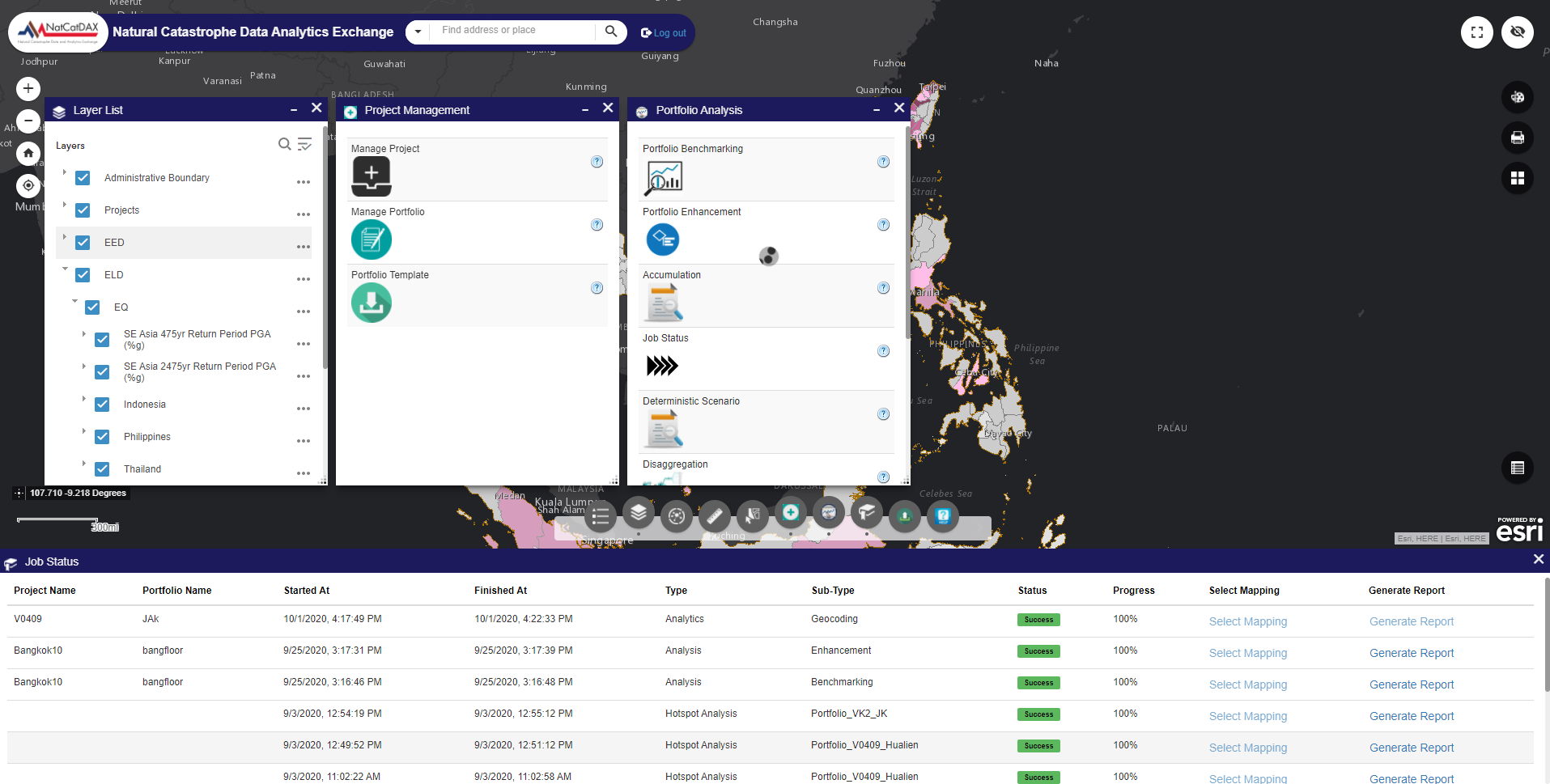
Urban Digital Twins are cutting-edge digital representations of cities that incorporate various geospatial data layers and enable real-time simulations and scenarios. By integrating high-resolution UAV imagery, Earth Observation data, sensor information, and authoritative geospatial data, these innovative systems create an immersive and interactive platform. This platform, often enhanced with virtual or augmented reality capabilities, empowers policymakers and urban planners to visualize, navigate, and explore urban landscapes, fostering informed decision-making and facilitating a comprehensive understanding of complex urban systems.
Through the integration of real-time data and advanced simulations, urban digital twins revolutionize the field of urban planning and development. They enable policymakers to generate real-time "what-if" scenarios, test different interventions, and assess their potential impact on the city. This dynamic and data-driven approach supports evidence-based decision-making, leading to more efficient resource management, optimized urban processes, and improved overall urban quality. Urban digital twins have the potential to transform the way cities are planned, designed, and managed, ultimately leading to smarter, more sustainable, and resilient urban environments.
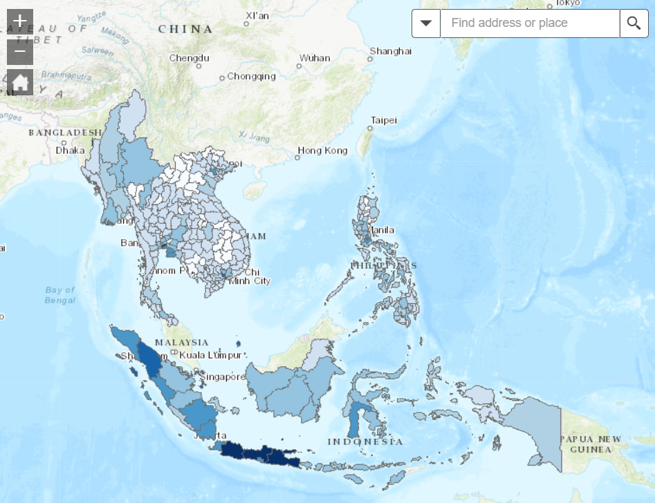
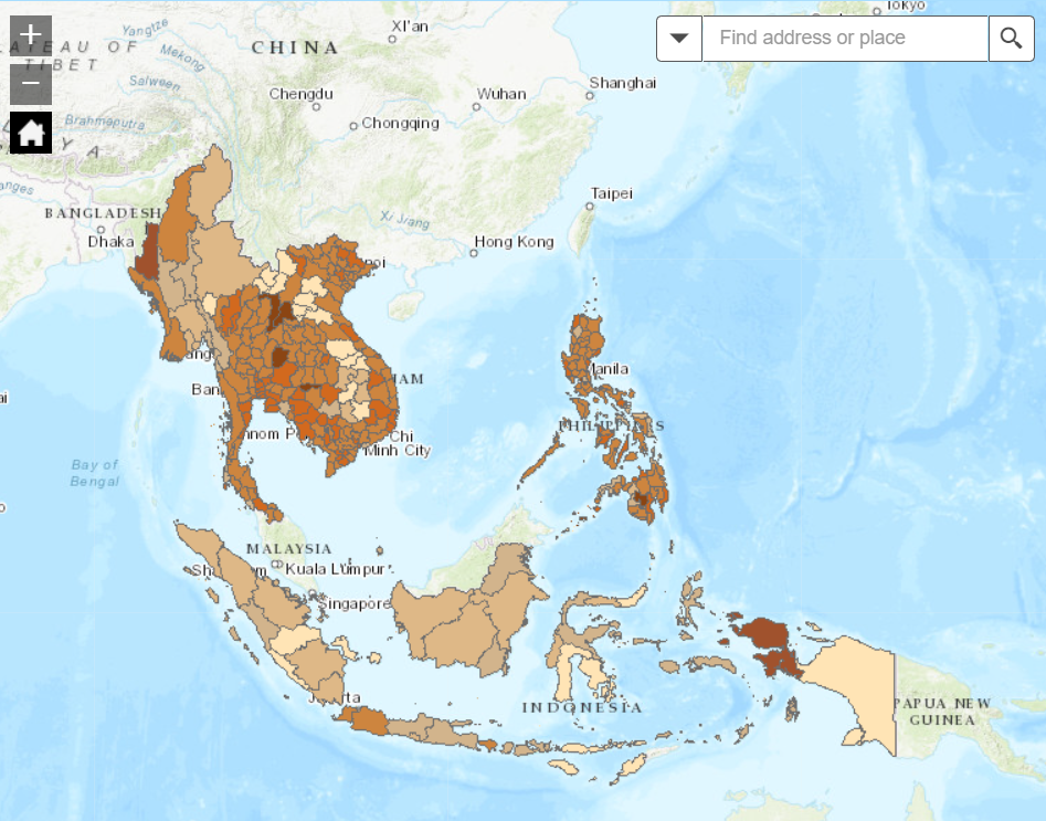
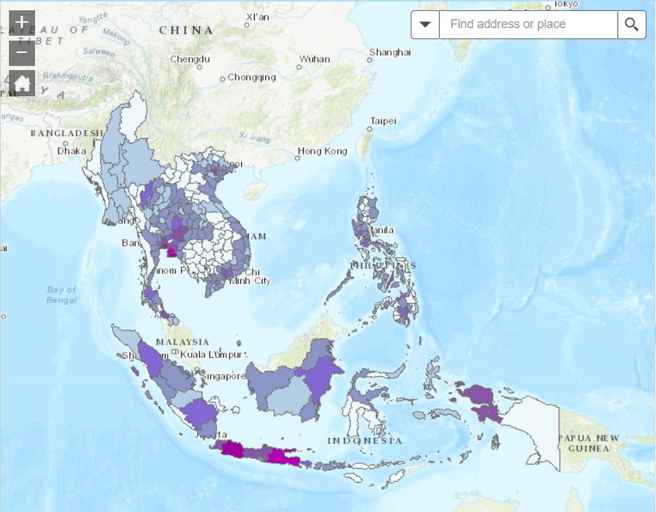
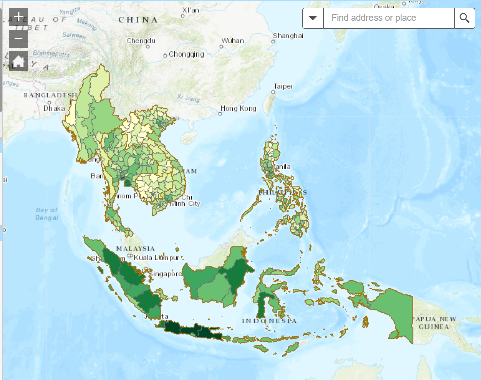
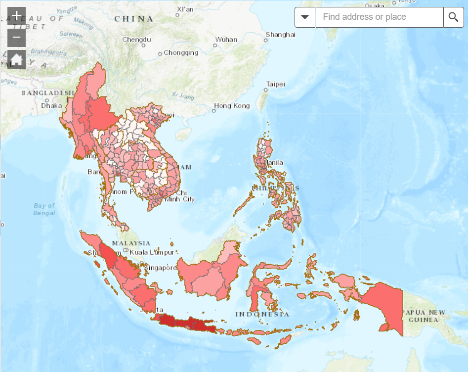
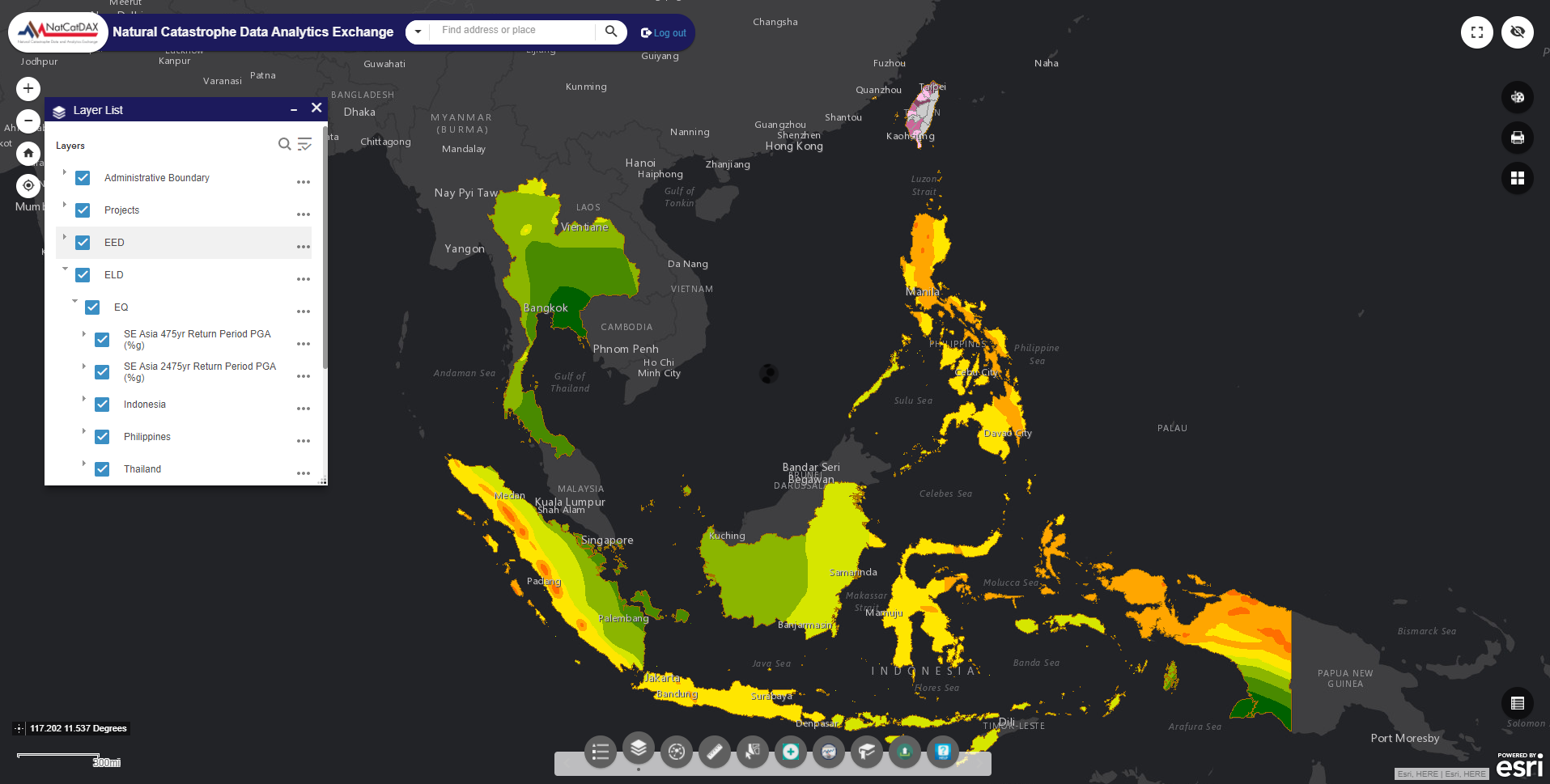
Geoinformation layers
To build a comprehensive model of any area, spatio-temporal data layers are combined, including satellite imagery for land cover and urban development, open data on buildings and points of interest for urban modeling, and mobility data for transportation optimization. Environmental hazard and weather data help assess risks and analyze climate patterns, while population data reveals demographic insights. Points of interest data aids in mapping and tourism planning. Integration of these data layers enables researchers and planners to gain holistic insights into urban development, environmental conservation, disaster management, and societal dynamics.
High-fidelity 3D model
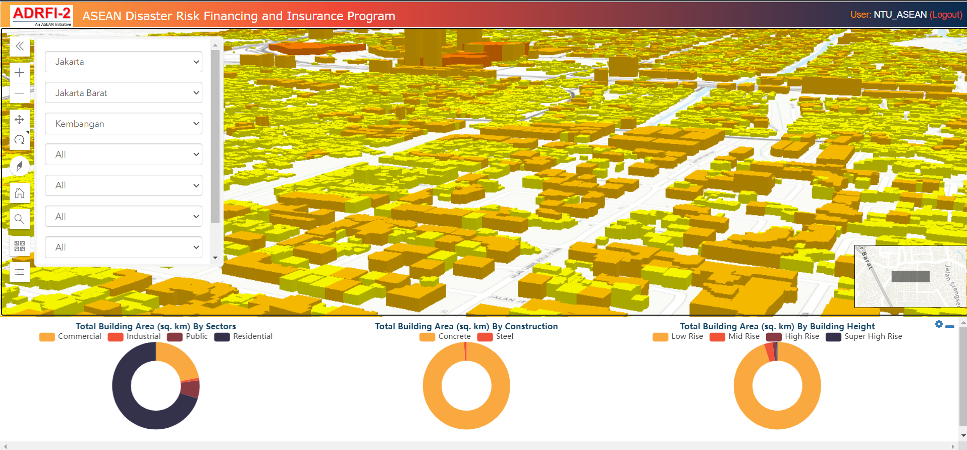
Using ultra-high-resolution multi-spectral drone and UAV imagery, capture intricate details with a resolution as fine as 3 cm or lower. Decision-makers can navigate these models interactively, gaining a comprehensive understanding of spatial context and making informed decisions. This technology finds applications in fields such as urban planning, architecture, environmental monitoring, cultural heritage preservation, and construction. Additionally, the integration of these models with virtual reality, GIS, and simulation systems enhances visualization, analysis, and training capabilities.
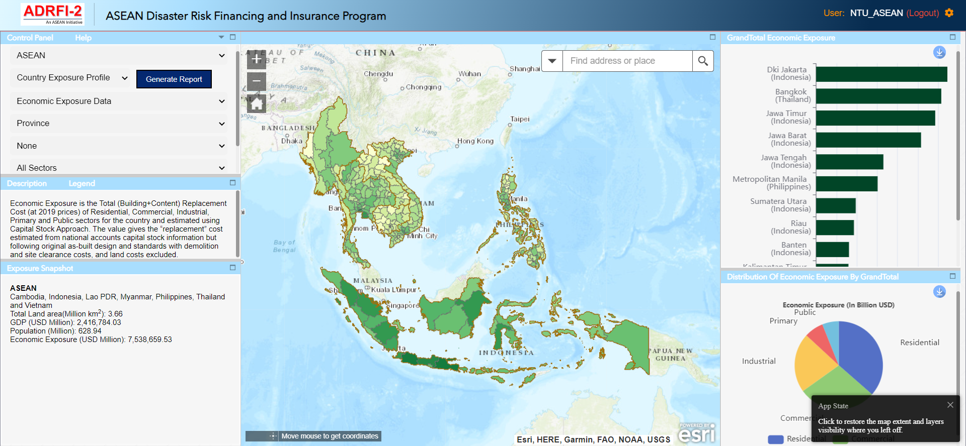
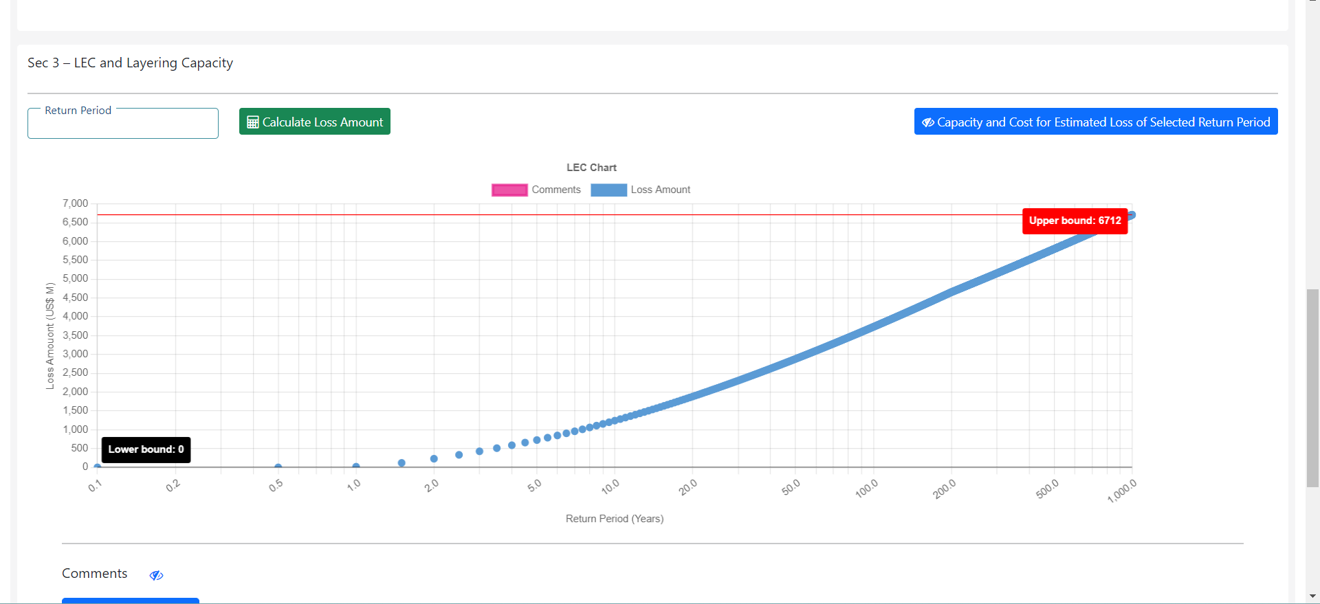
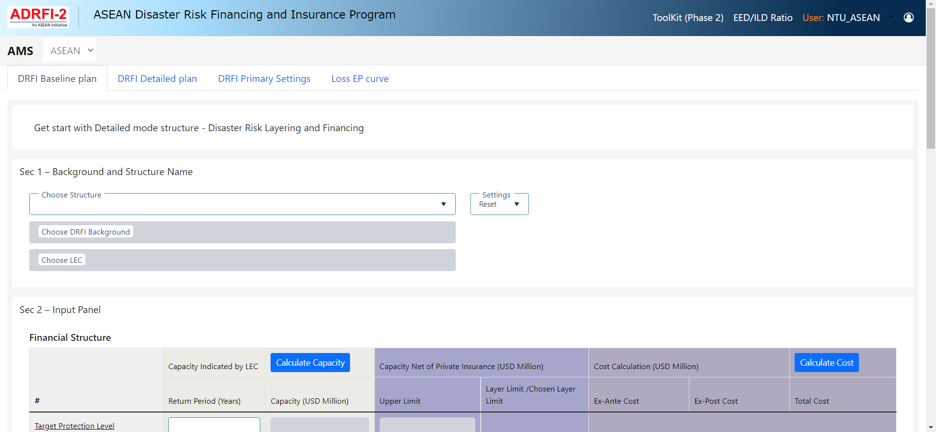
ADRFI Project