Climate Change is the defining issue of our time and we are at a defining moment. From shifting weather patterns that threaten food production, to rising sea levels that increase the risk of catastrophic flooding, the impacts of climate change are global in scope and unprecedented in scale. Without drastic action today, adapting to these impacts in the future will be more difficult and costly.
Implementation
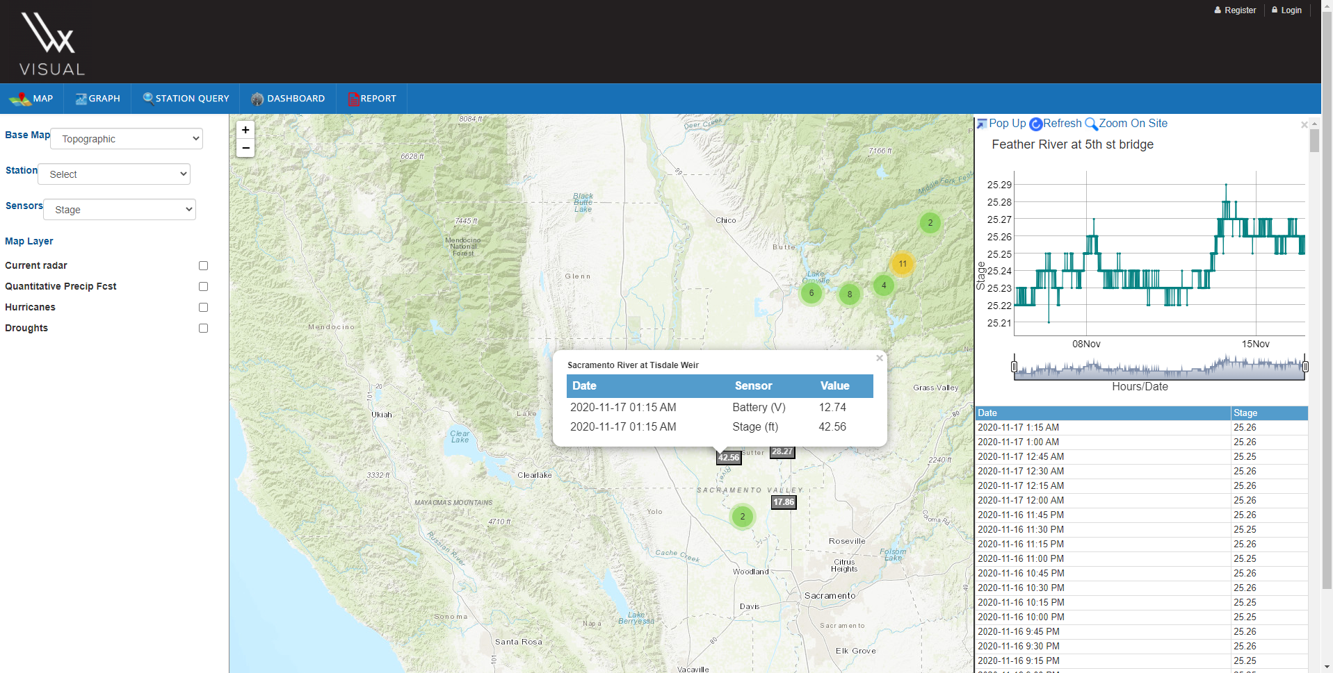
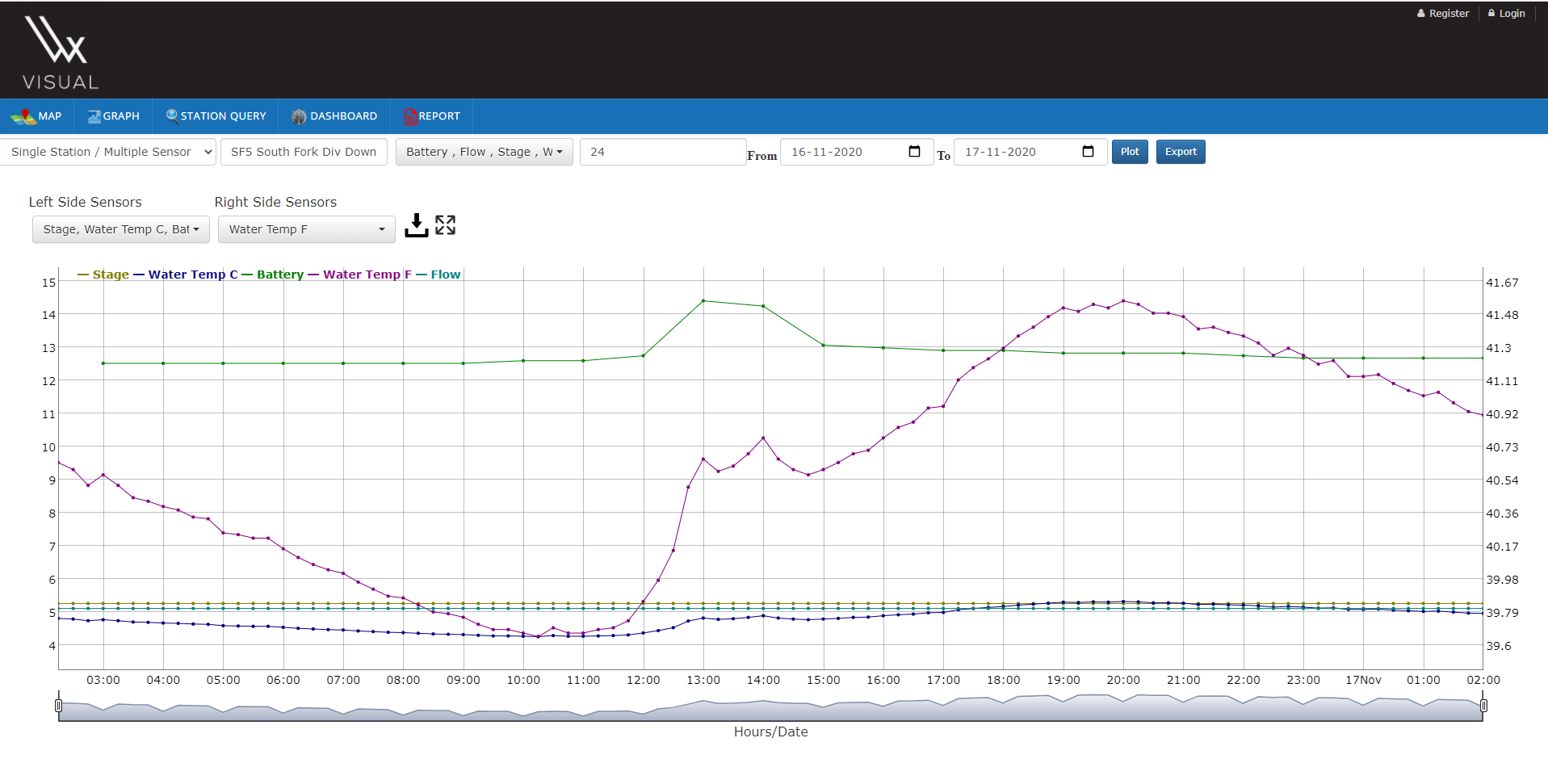
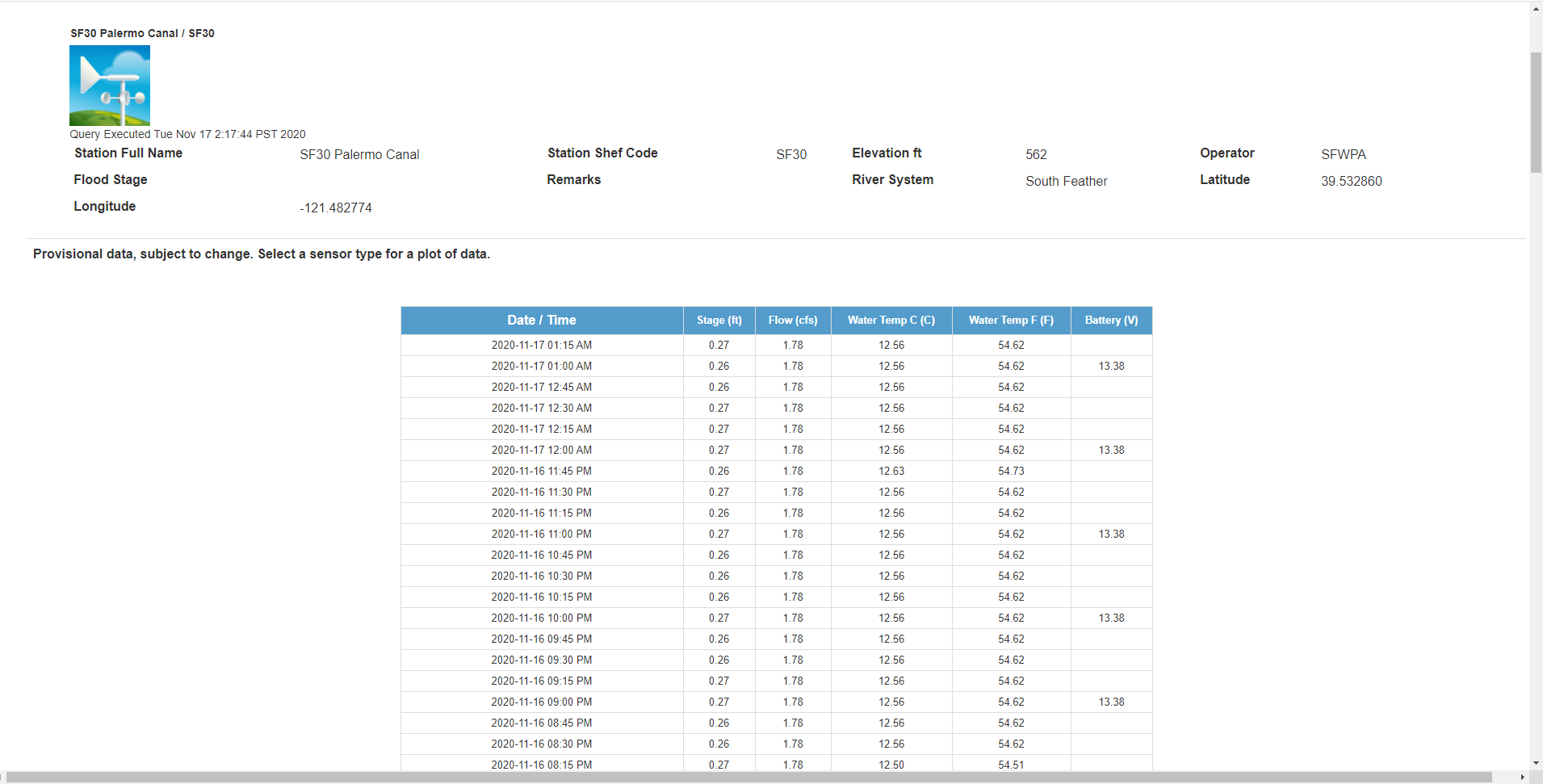
GISFY's HEWS solution provides real-time weather, water, early warning, and climate information products to end users, based on weather, water and climate data. Our solution includes the following.
Collecting data from automated weather stations through standard SHEF format.
Allow user to view and query real time weather parameter data on the map, graph, chart and tables.
Send early warning through SMS and email in case of climate disaster.
Conclusion
GISFY's HEWS is deployed in USA, Saudi Arabia and many Central Asian countries.
Hindon River Pollution MIS (HRP MIS)
HRP MIS Project
Challanges
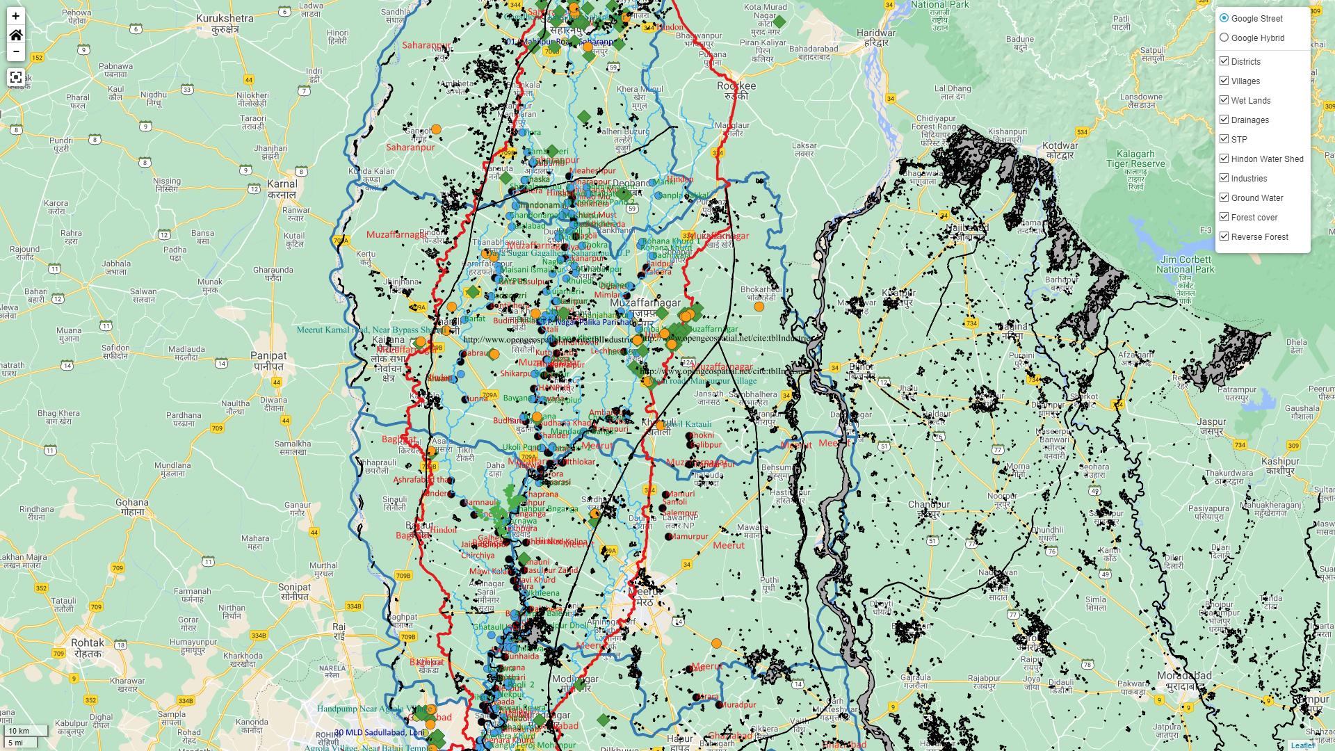
Industries and government institutions in NCR region, India wants to check the water pollution in Hindon river and implement mitigation plan to contain the pollution.
Implementation
GISFY's HRP MIS System including the following.
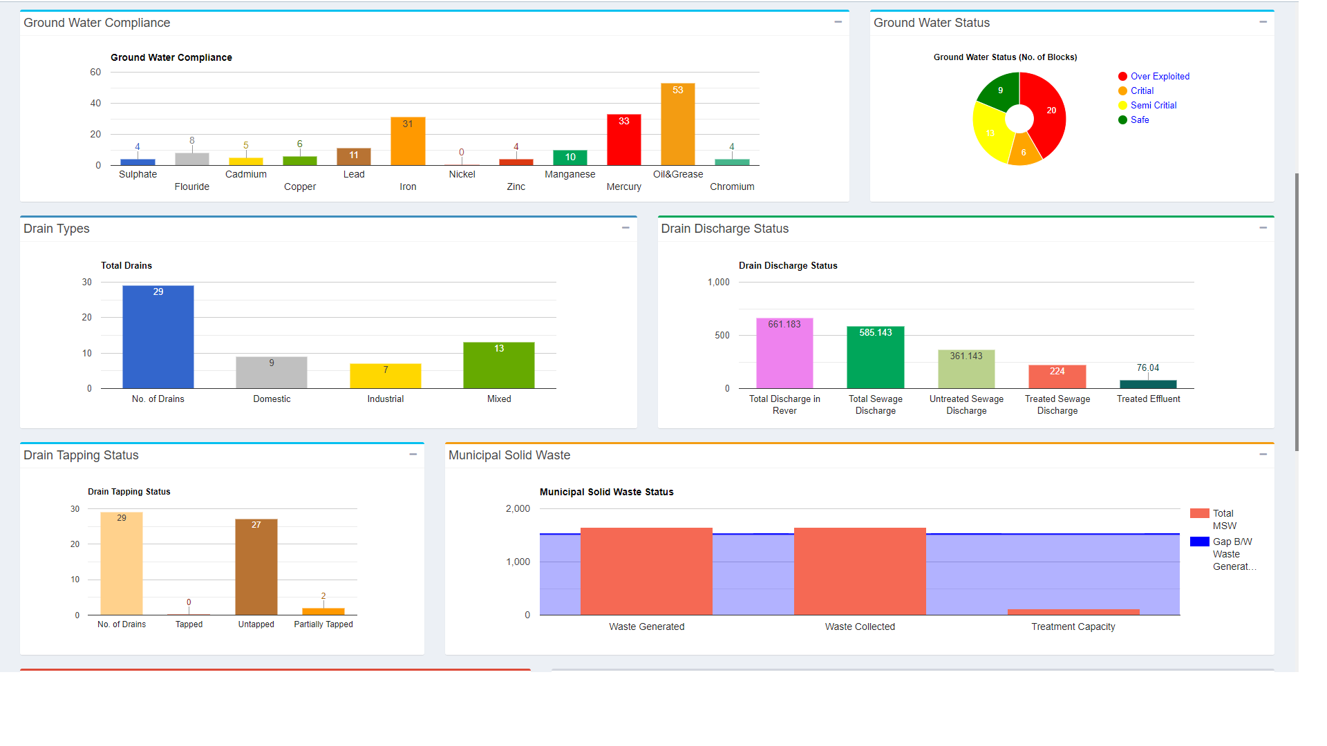
Solution includes complete dataset of pollution indicators for example sewage, biomedical waste, drainage discharge, drain tapping, municipal water waste, industries and hazardous waste.
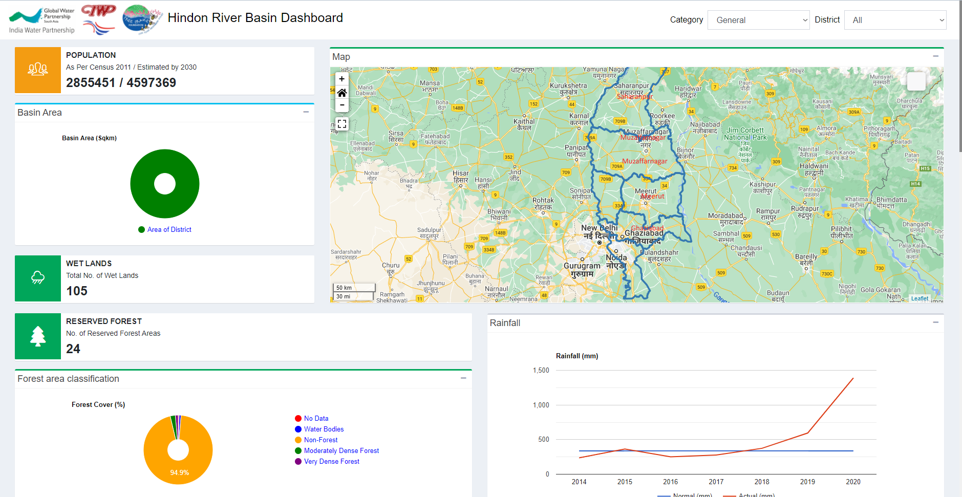
Solution also includes complete dataset of general indicators for example population, basin, wetlands, forest area classification, rainfall, soil texture, soil classification, ground water level, LULC, agriculture and irrigation
Analysis tool to show the current situation of pollution in Hindon river basin.
MIS System to manage above the indicator dataset.
Comparison tool to evaluate base data with latest data to check effectiveness of mitigation plan implemented.
WebGIS to view various data on the map.
Conclusion
Various government institutes and organization are using GISFY’s HRP MIS to maintain the information of various indicators and implement mitigation plan.
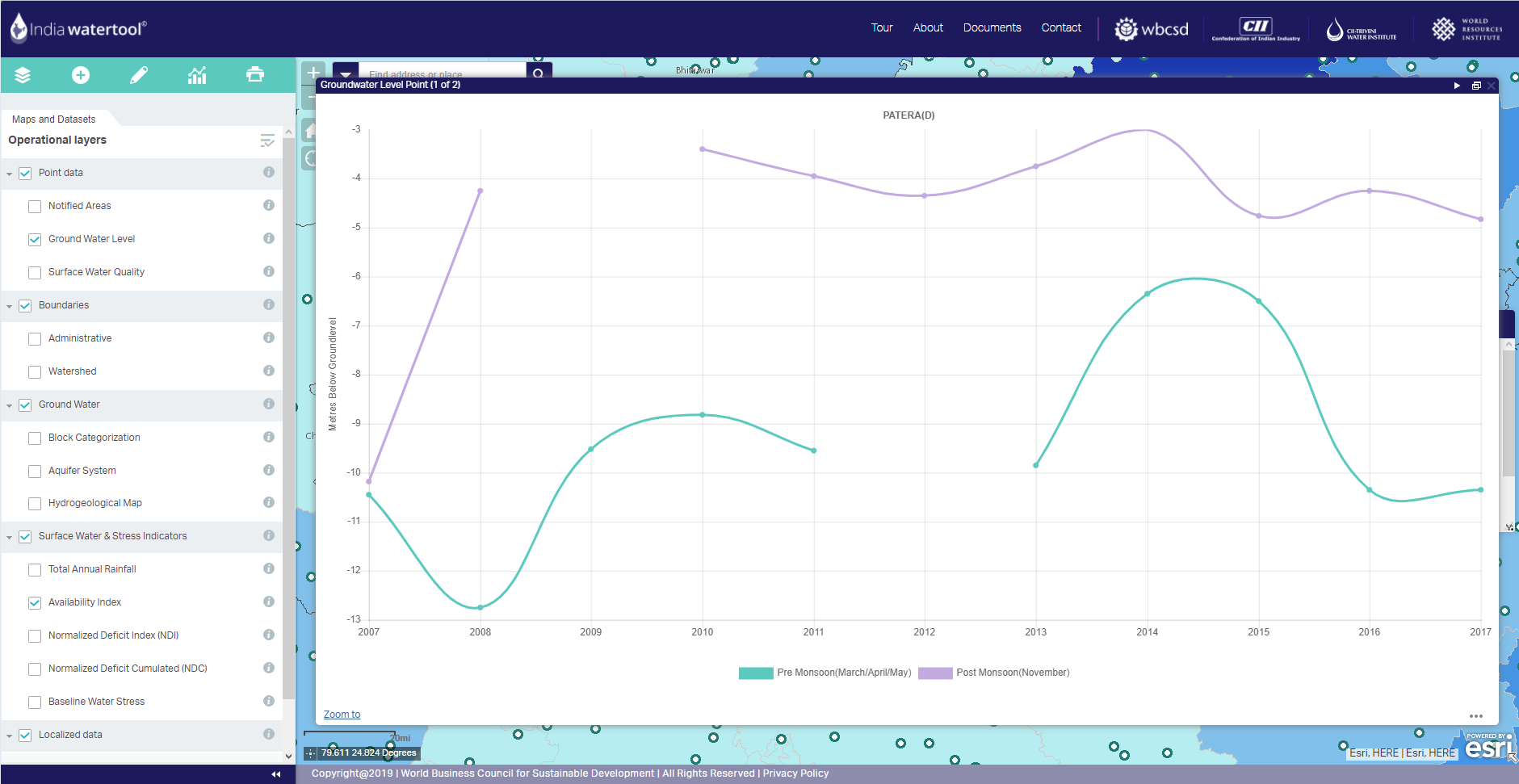
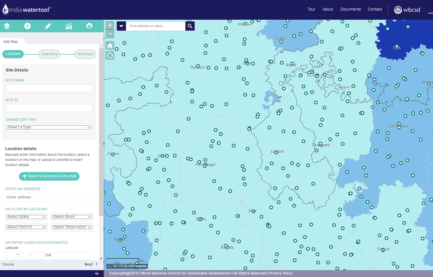
India Water Tool (IWT)
IWT Project
Challanges
Industries and government institutions in India wants to check there water risk and plan intervention for water management.
Implementation
GISFY's IWT solution includes the following.
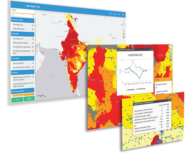
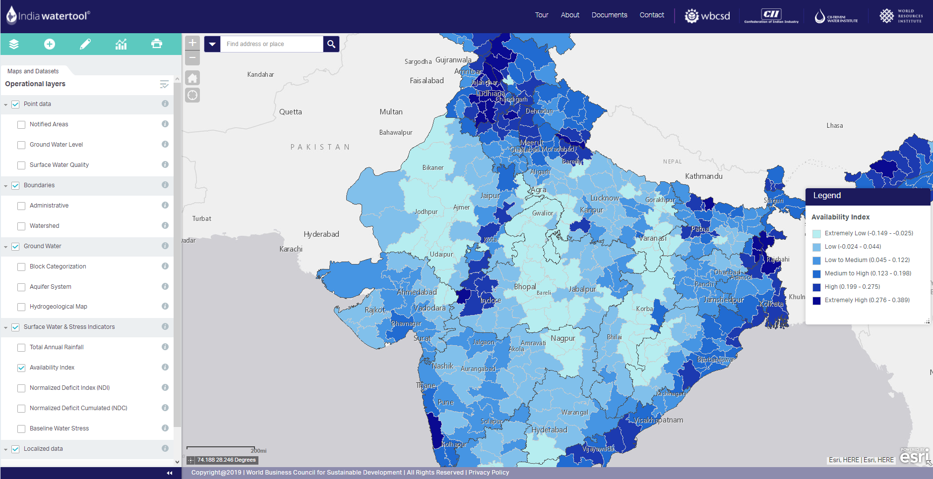
WebGIS that allows user to view various water quality and quantity related maps overlaid on satellite and street map.
Includes complete information of surface water and ground water.
Allow user to import their area of interest location and perform analysis for decision-making.
Conclusion
Various institutes and organization including ITC, Aditya Birla Group, BASF, Bayer, L&T, Nestle, etc are using GISFY’s IWT.
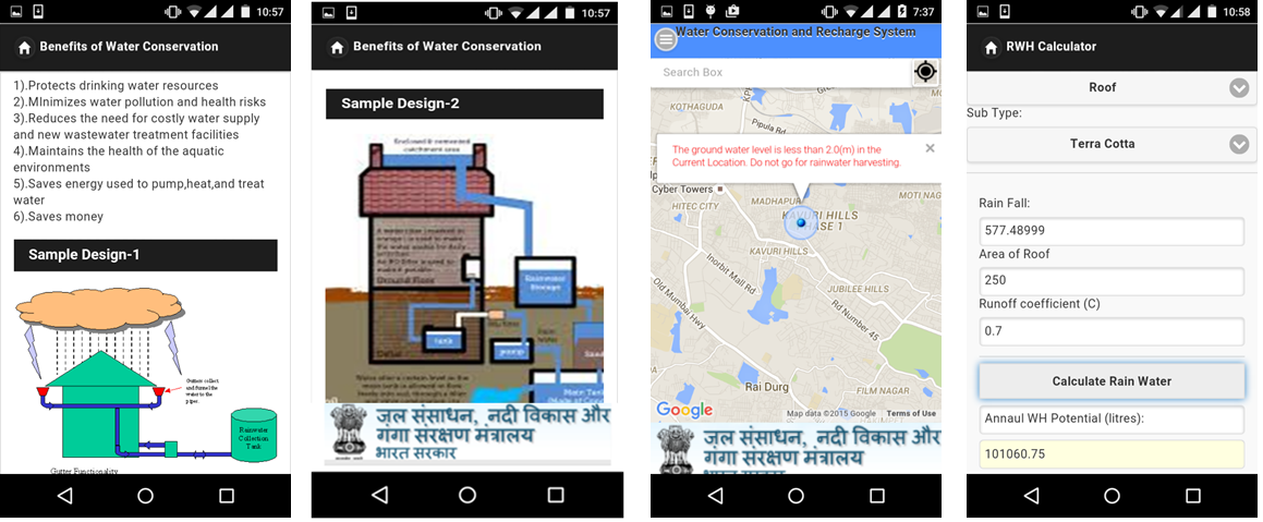
JalSanchayan
JalSanchayan Project
Challanges
The government of India wants to raise awareness regarding water scarcity in India and different measures citizens can take to conserve water.
Implementation
GISFY's developed JalSanchayan Mobile with following features
Comprises all components of rainwater harvesting in single platform.
It allows user to know from location conditions and interactive module enable user to calculate potential rainwater to be harvested in user’s location.
In addition, it also provide schematic designs, benefits and operation and maintenance aspects.
It also provide contact information of authorities, agencies, technical institutions and grass root community organizations working in the water sector.
Conclusion
More than 1, 00,000 users have download and using JalSanchayan.
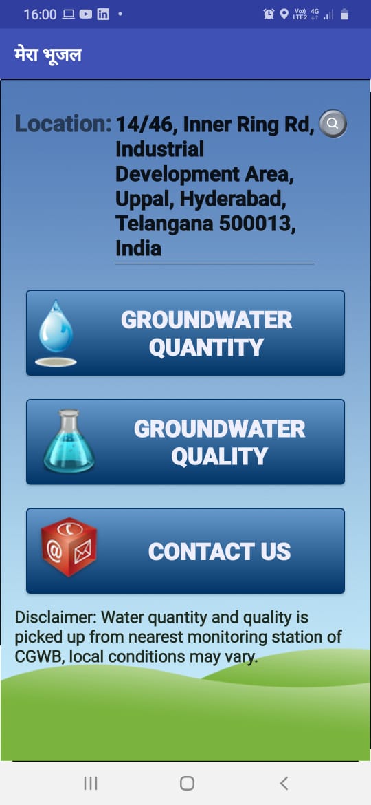
MeraBhujal
MeraBhujal Project
Challanges
The government of India wants to raise awareness among citizens regarding ground water situation in their current location.
Implementation
GISFY's developed MeraBhujal Mobile with following features.
Information available both in Hindi and English
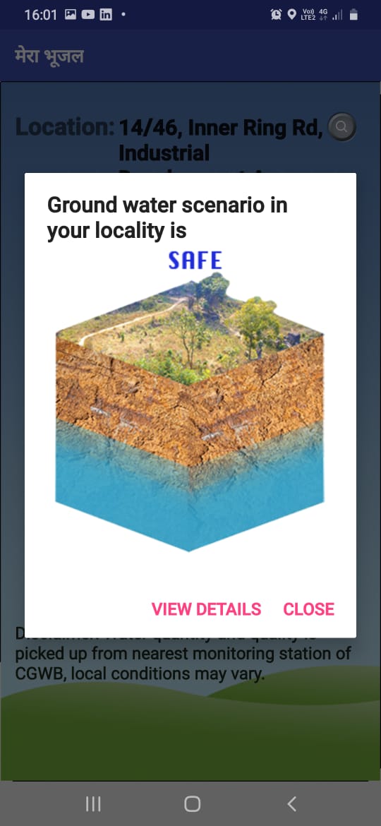
Provides ground water resources information for users current/desired location
Information on annual ground water availability and withdrawal
Stage of ground water withdrawal
Indicates the withdrawal stages in colour coded format
Suitable suggestions to augment the ground water
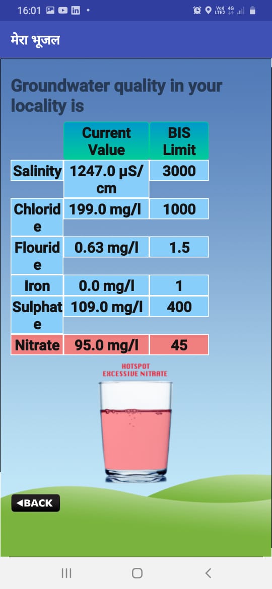
Provide ground water quality information of user locality
Suitable suggestions for sustainable utilization of ground water
Conclusion
More than 1, 00,000 users have download and using MeraBhujal.