GIS Application Development
GIS Application Development
We are experting in developing following GIS Applications in both the opensource and ESRI platform.Web GIS: We can build Web GIS Solution with following features.
- Supports Google map, Bing map, Yahoo maps and Open Street Map as base layer.
- All common GIS functionality like PAN, Zoom In, Zoom Out, Info Tool is available in the application.
- Supports data download in the form of Shapefile, Image, MS Excel, CSV, PDF and MS Word.
- Data can be queried by attribute and geometry.
- Allows user can also edit attribute and geometry.
- Available in both the Open Source and ESRI technology based on preference of client.
- Custom modules can be integrated based on your requirements.
Mobile GIS: We can build MOBILE based GIS survey solutions with following features.
- Supports Google map, Bing map, Yahoo maps and Open Street Map as base layer.
- All common GIS functionality like PAN, Zoom In, Zoom Out, Info Tool is available in the application.
- Supports data download in the form of Shapefile, Image, MS Excel, CSV, PDF and MS Word.
- View current location navigate using GPS.
- NO SIM required for Survey. Works in a location where there is no mobile network.
- The survey can be done in both the offline and online mode.
- Capture videos, photos while doing survey.
- Chat with peers while doing the survey.
- Integrated with Web GIS and Desktop GIS.
- Download survey data.
- Generate and download analysis report based the survey data.
- Authenticated and authorized secured access.
- Data can be queried by attribute and geometry.
- Allows user can also edit attribute and geometry.
- Available in both the Open Source and ESRI technology based on preference of client.
- Custom modules can be integrated based on your requirements.
Dekstop GIS: We can build Desktop GIS Solution with following features.
- Supports Google map, Bing map, Yahoo maps and Open Street Map as base layer.
- All common GIS functionality like PAN, Zoom In, Zoom Out, Info Tool is available in the application.
- Supports data download in the form of Shapefile, Image, MS Excel, CSV, PDF and MS Word.
- Data can be queried by attribute and geometry.
- Allows user can also edit attribute and geometry.
- Available in both the Open Source and ESRI technology based on preference of client.
- Custom modules can be integrated based on your requirements.
Some of GIS Application Developed by Us Avaialable in Public Domain
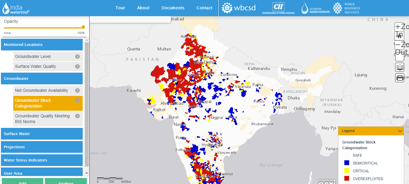
India Water ToolBelize National Spatial Data Infrastructure
BIM 3D WebGIS
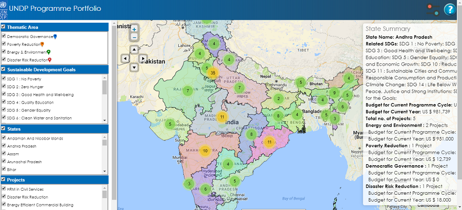
UNDP Projects Page
NatCatDAX
Mera Bhujal
Zoological Survey of India
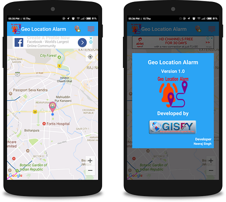
GeoLocation Alarm
Reinsurance Treaty Calculator